 Tideline
You're at the ramp.
No signal.
What time's low tide?
Tideline works offline once installed: tide charts, launch windows and bite times for 310+ ports, Kaitaia to Bluff, with nothing to load at the ramp.
Pick your port, set the tide your ramp needs, and read the day at a glance. Save your fishing spots and log what you catch, with the predicted tide kept for each catch. Turn on depths, rocks and wrecks from LINZ's chart data, as a guide: not for navigation. A reminder before the tide, a summary the evening before and king tide alerts, if you want them. Cheaper than a bakery pie.
$4.90 NZD once, on each store. No subscription, no ads, and tide data updates included.
Version 1.7.2, on the App Store, Google Play and the Microsoft Store.
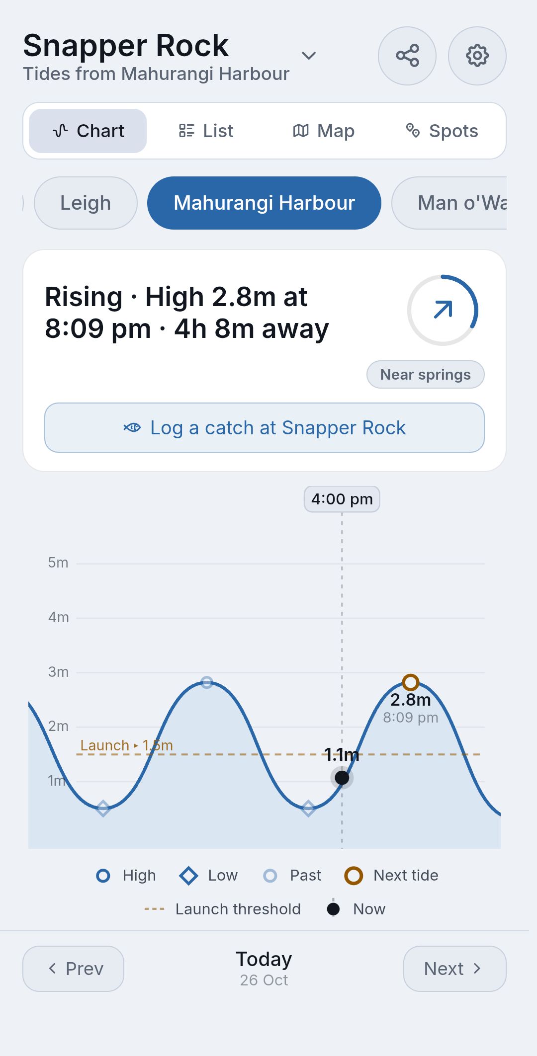
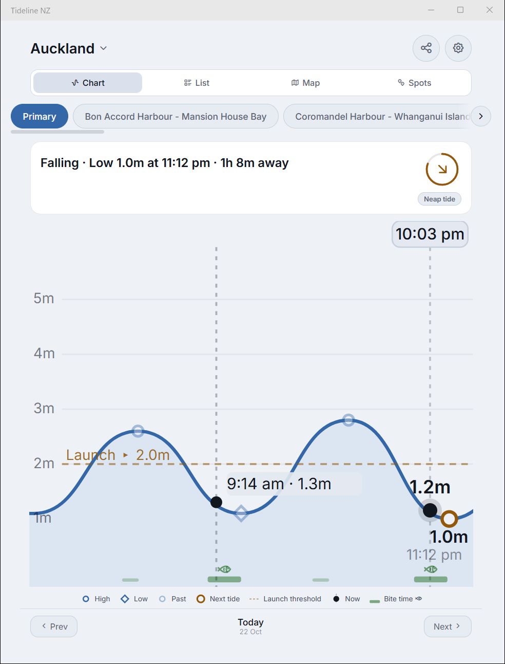
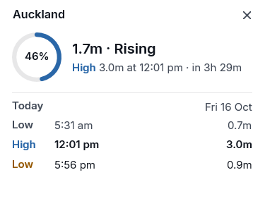
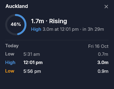
Today's Auckland tides, live
… · real data, refreshed daily by the same pipeline that feeds the app.
Move your mouse (or finger) over the chart to scrub.
Tideline NZ is a tide app for New Zealand that predicts the height of the tide at any time of day at 310+ ports, from LINZ data, and works without a connection. This is one port and one day; the app covers the coast with charts, lists, a map and more.
On your phone, tablet, PC and watch
The same Tideline NZ on iPhone, iPad, Android and Windows, with every port offline on each, and a tile for Wear OS watches. Buy it once in a store and it's yours on every device signed in to that store.
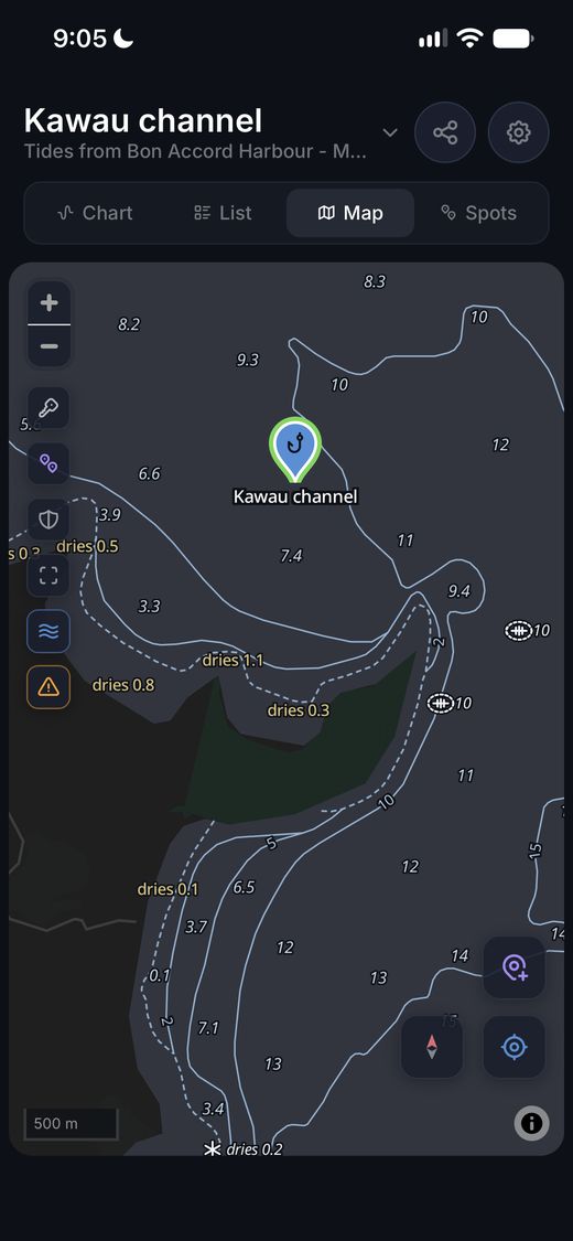
iPhone
iOS 15 or later, version 1.7.2. Home screen widgets on iOS 17 or later.

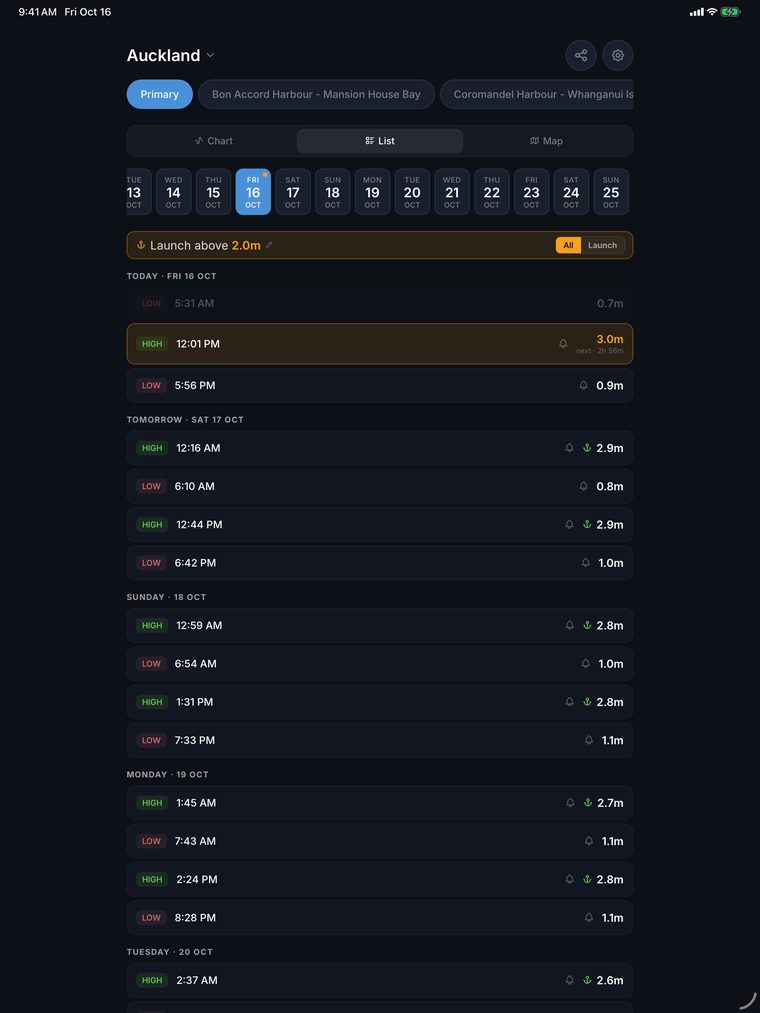
iPad and Mac
The same app on a bigger screen, and on Macs with Apple silicon. One App Store purchase covers iPhone, iPad and Mac.
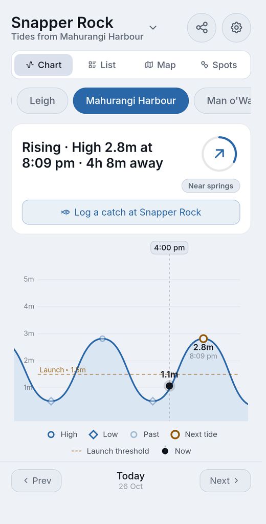
Android
Android 7.0 or later, version 1.7.2, with three home screen widgets: the next tide, the tide now, and the day's tides.

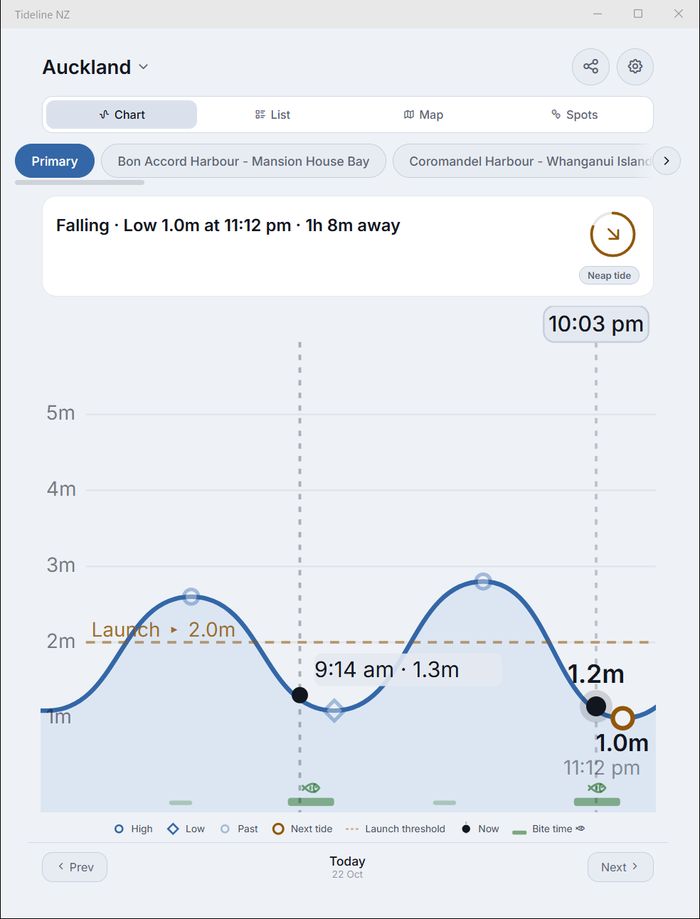
Windows
Windows 10 (version 1809) or Windows 11 on a 64-bit PC, version 1.7.2, with notifications, a mini window and an icon by the clock.


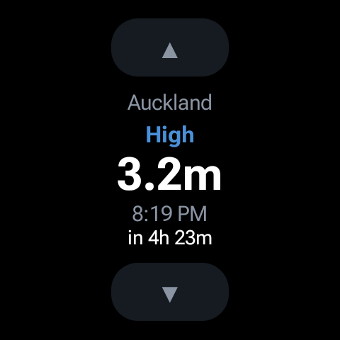
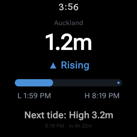
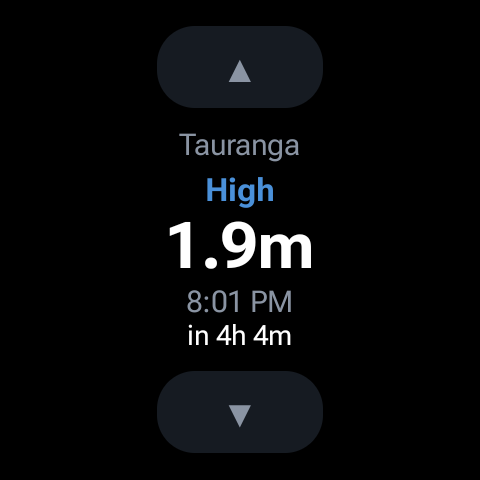
Galaxy Watch and Wear OS
Wear OS 3 or later, with Tideline on your Android phone: a tile with the next tide and a countdown, and a complication for your watch face. The tile's arrows step through your pinned ports, and a tap opens the tide now.
Three steps to the ramp
No account and no setup screens. This is all it asks.
Pick your port
Search a place or a harbour ("kaipara" finds all 12 Kaipara Harbour ports, none of which is called Kaipara), or use your location to find the nearest. Pin up to five regulars to the top.
Set your launch height
The tide your ramp needs, from 0.5 to 5.0 m. A dashed line marks it on the chart, and an anchor marks every tide above it in the list.
Read the day
The chart shows where the tide is now and where it's going, with spring or neap context. The list runs weeks ahead, and the map shows the ports around you.
Built for the boat ramp
What Tideline NZ does: tide predictions for the New Zealand coast, on your device, with the details that save a wasted trip.
Tap the ring beside the summary for the height now, how far through the tide you are, sunrise, sunset and the moon. Share a tide with your crew from the header, or long-press any tide in the list to share that one. Each widget can follow the app or show one of your pinned ports.
Your spots, your log
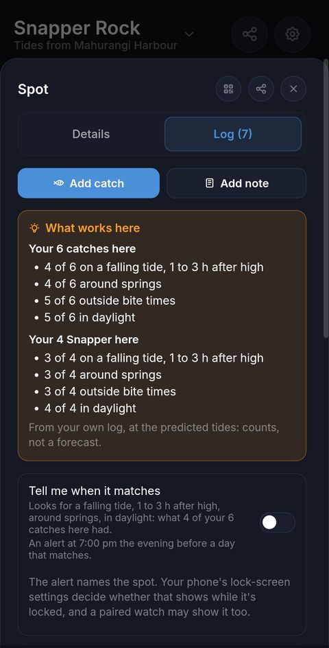
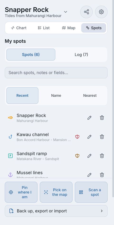
Save the places you fish, launch or dive, and keep a log of what you catch there. Included in the price, and kept on your device.
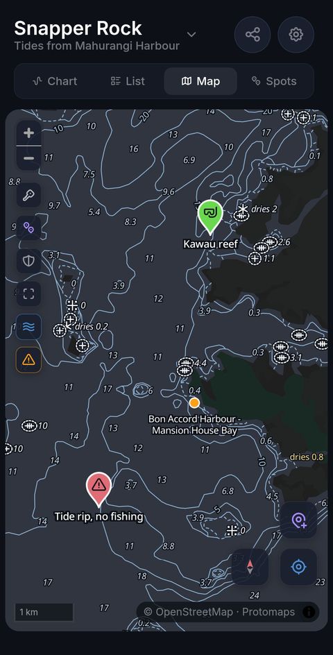
- Spots on the map. Long-press the map to save a spot (right-click on Windows), or pin one where you are. Give it an icon, a colour, notes and fields such as species, best tide, depth and bait. A spot shows its port's tides, with bite times, sunrise and sunset worked out at the spot.
- A log for every spot. Catches and notes, with photos. Each entry keeps the predicted tide, moon and bite time for when it happened. After 3 catches, What works here shows what they have in common, as counts, never a forecast.
- Tell me when it matches. Once a spot's catches share a pattern, turn this on for an alert the evening before a day with those conditions, with the times they hold.
- Send a spot to a mate. Show it as a QR code, and a mate with Tideline 1.5 or later scans it with Scan a spot. No internet and no link, and never your log or photos.
- Marine reserves on the map. Marine reserves and the Hauraki Gulf's protection areas show on the map, and a spot inside one says so, with a link to DOC's page. Boundaries are a guide.
- Every spot in one place. Spots is a view of its own beside Chart, List and Map: your spots and the whole log, with search, kept as you left it.
- Yours to keep. Back up everything saves your spots, log and photos to one file you keep. Export and import spots as GPX or CSV.
Depths, rocks and wrecks
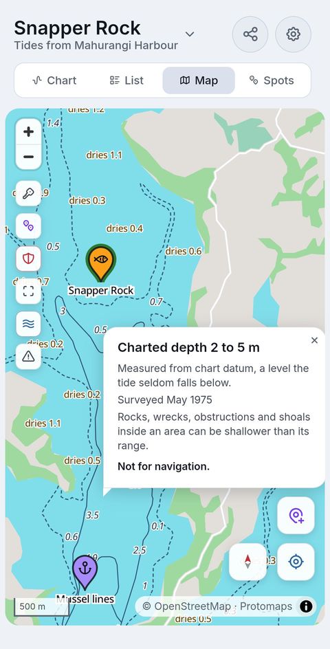
Two buttons on the map, off until you turn them on, draw LINZ's nautical chart data, simplified for this map, around the places you fish and launch.
- Depths. Depth lines and charted depths below chart datum, drying heights, unsurveyed areas and dredged channels.
- Rocks and wrecks. Rocks, wrecks, foul areas, foul ground and fish havens, as LINZ charted them.
- Tap for the depth. Zoomed in, tap the water for its charted depth range and date, or a rock or wreck for what's charted there. Depth on tap, under Settings, Map, turns that off.
- Read the note. The first time you turn each one on, a note says what it leaves out.
Not for navigation. LINZ last published this data in 2023 and charts only some hazards, and rocks, wrecks and shoals can be shallower than an area's range. On the water, use an official chart.
On your PC, too
The Windows app is the same Tideline NZ in a window that behaves like a desktop app: it reopens where you left it, Esc closes a sheet, and right-click pins a port or shares a tide.
- Windows notifications. A reminder before a tide, the evening summary and king tide alerts arrive even when Tideline NZ is closed, as long as the PC is on. Click one to open that port.
- The mini window. The tide now and the next tide in a small window on top of your others, unless you turn that off. Expand it for today's tides.
- An icon by the clock. Point at it for the port and the height now. Close the window and Tideline NZ waits there; right-click the icon for the mini window, Settings and Exit.
- Start with Windows. Tideline NZ starts as just the icon when you sign in.
- Your spots on a big screen. Right-click the map to save a spot, keep its log, and save backups and exports where you choose. With a webcam, Scan a spot reads a mate's code; Windows asks before Tideline NZ uses the camera.
- Depths with a click. Click the water for its charted depth range, or a rock or wreck for what's charted there; Depth on click, under Settings, Map, turns that off. Not for navigation.
The mini window, the icon and Start with Windows each stay off until you turn them on in Settings. Windows 10 version 1809 or later, or Windows 11, on a 64-bit PC.
What's new
Version 1.7.2, October 2026, on the App Store, Google Play and the Microsoft Store. Updates arrive through each store on their own.
1.7.2 October 2026
- Depths, and Rocks and wrecks: two buttons on the map, each off until you turn it on, drawing LINZ's nautical chart data, simplified for this map. Zoomed in, tap the water for its charted depth range and date, or a rock or wreck for what's charted there. Not for navigation: LINZ last published this data in 2023, so on the water, use an official chart.
- Spots, a view of its own beside Chart, List and Map: your spots and the whole log, with search, kept as you left it.
- Open a catch or note and tap one of its photos to see it full screen, with the next and previous, and zoom in for a closer look.
- The row of a port's secondary ports now sits under the view buttons, on Chart and List.
- On iPhone and iPad, 1.7.2 is the first update since 1.1.7, so it brings everything below too: fishing spots and their log, Tell me when it matches, spots by QR code, Back up everything, marine reserves on the map as a guide, the light and Sunset themes, the rebuilt notifications and harbour search.
- On Android, 1.7.2 is the first update since 1.3.0, so it brings everything from spots on, and Tideline for Wear OS watches: a tile with the next tide and a countdown, and a complication for your watch face.
Earlier versions
1.5.0 October 2026
On the Microsoft Store only; iPhone, iPad and Android have it in 1.7.2.
- A log for every spot: catches and notes with photos, each keeping the predicted tide, moon and bite time. After 3 catches, What works here shows what they have in common, as counts, never a forecast.
- Tell me when it matches: an alert the evening before a day like your catches.
- Spots by QR code: show a spot as a code, and a mate with Tideline 1.5 or later scans it with Scan a spot. No internet and no link.
- Back up everything: your spots, log and photos in one file you keep.
- Marine reserves and the Hauraki Gulf's protection areas on the map, and a spot inside one says so, with a link to DOC's page. Boundaries are a guide.
- A Sunset theme: light by day, dark from sunset to sunrise at the spot or port you're viewing. The map follows the theme, and has a full-screen button.
1.4.0 October 2026
Fishing spots on the map. On the Microsoft Store only; iPhone, iPad and Android have them in 1.7.2.
1.3.0 October 2026
On the Microsoft Store and Google Play; iPhone and iPad have it in 1.7.2.
- A light theme. Choose Light, Dark or Auto under Settings, Appearance; Auto follows your device.
- Notifications rebuilt: an evening summary of the next day's high tide and launch window, king tide and big spring tide alerts about once a month, and a bell on each tide that sets or cancels a reminder.
- Search finds harbours: "kaipara" lists the 12 Kaipara Harbour ports.
- Each home screen widget on Android and iPhone can follow the app or show one of your pinned ports.
- On Windows: notifications, the mini window, an icon by the clock and Start with Windows, and a window that reopens where you left it.
- Use my location says why when it can't find you, instead of guessing a port.
1.1.7 August 2026
The tide chart reworked for bigger displays.
Sync for your spots?
Would you like your spots backed up and synced across your devices, for a small yearly fee? Tell us, and we'll let you know when it's ready.
Email us about syncSaid plainly
Tide apps are everywhere, and LINZ publishes these predictions for free. Here is what this one does not do, so nobody finds out after paying.
- Predictions, not measurements. Tideline NZ shows predicted tides, not live gauge readings. Wind and air pressure can push the real tide away from any prediction.
- Not for navigation. These are not official tide tables as specified in Maritime Rules Part 25. Check official sources and local conditions before heading out.
- Heights and times, not currents. It predicts how high the water is, not which way or how fast it flows.
- Bite times are a convention. Solunar periods are a fishing tradition worked out from the moon, the same method the magazine tables use. A guide, not a prediction.
- New Zealand ports only. The 17 standard ports and 305 secondary ports LINZ publishes. Chatham Islands times are in NZ time: add 45 minutes for Chatham time.
- Each platform has its own extras. Home screen widgets are on Android and iPhone; the mini window and the icon by the clock are on Windows; the watch tile and complication are for Wear OS watches paired with an Android phone, not Apple Watch.
- Depths are a guide, not a chart. Depths, rocks and wrecks are simplified from LINZ's chart data, last published in 2023, and LINZ charts only some hazards. Not for navigation: on the water, use an official chart.
- Your spots don't sync. They stay on the device you saved them on. Back up everything makes a file you can restore on another device with Tideline 1.5 or later.
- Protected areas are a guide. Boundaries are indicative, and some places have their own rules. Check DOC's pages before you fish: marine reserves and the Hauraki Gulf's protection areas.
Questions people ask
Does it work without phone signal?
Yes. Once installed, Tideline NZ has every port's predictions on your device, so the chart, the list, the map and your reminders all work offline. When you do have a connection, it checks once a day for new tide data.
Where does the tide data come from?
From Land Information New Zealand (LINZ): its predictions for the 17 standard ports, and its secondary port table, which corrects the times and heights for 305 more places. LINZ publishes new predictions each year, and the app picks them up on its daily check.
LINZ publishes tide predictions for free. Why pay?
It does, as tables on its website, and they are the same predictions Tideline NZ is built on. Tideline puts them on your device offline, as a chart you can read at a glance, with launch windows, reminders, widgets, a map, and your own spots with a catch log, for $4.90 NZD once.
Which ports does it cover?
All 17 LINZ standard ports and 305 secondary ports, from Kaitaia to Bluff, the Chatham Islands included. 310+ of them are on the offline map, and search finds every one by place or harbour.
Is there a subscription?
No. $4.90 NZD once, no ads, nothing to buy inside the app, and tide data updates are included.
Which devices does it run on?
iPhone and iPad on iOS 15 or later, Android 7.0 or later, Windows 10 version 1809 or later or Windows 11 on a 64-bit PC, and Macs with Apple silicon through the App Store. Home screen widgets need iOS 17 or later on iPhone. The watch tile and complication need Wear OS 3 or later and Tideline on an Android phone.
Do I pay again on another device?
Not within one store: install it again on any device signed in to the same account and it shows as yours. Each store sells its own copy, so an iPhone and a Windows PC are two purchases.
Does it track me?
No account, no analytics and no crash reporting. Your location is used on your device only, to find the nearest port, show you on the map and pin a spot where you are. The only server Tideline NZ talks to is SumnerD's own, for the daily data check.
Where are my spots and catches kept?
On your device, with no account and no sync. Back up everything saves your spots, log and photos to one file you keep, and restores them on any device with Tideline 1.5 or later. On Android, your backup to your Google account includes your spots and log, without the photos, when it's on. On Windows, uninstalling Tideline NZ removes them, so keep a backup file.
Can I send a spot to a mate?
Yes, by QR code. Show the spot's code on your screen and your mate scans it with Scan a spot in Tideline 1.5 or later. No internet and no link: the code holds the spot's name, place, icon, colour and tide port, and its notes and fields only if you choose, never your log or photos.
Can I navigate by the depths?
No. Depths, and Rocks and wrecks, are simplified from LINZ's chart data, last published in 2023, and LINZ charts only some hazards, so rocks, wrecks and shoals can be shallower than an area's range. They're a guide to the water around your spots. On the water, use an official chart.
More answers, with short clips of the app, in the Tideline NZ help.
310+ ports nationwide
17 standard ports with full tide predictions, plus 305 secondary ports with time and height corrections, Kaitaia to Bluff. Tap a standard port below to see every secondary port it covers.
Every one of these gets the full treatment in the app: tide charts, launch windows, spring and neap context, and bite times.
Get Tideline NZ
One-time purchase. No subscription, no ads. Tide data updates included.
iPhone & iPad (iOS 15+) · Android · Windows · Mac (Apple silicon) · Wear OS
Version 1.7.2, on the App Store, Google Play and the Microsoft Store.